Tag: GPS metadata
-
Photo Mapper
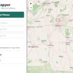
A small field-visit tool for mapping geotagged photos. PhotoMapper reads GPS metadata from uploaded photos, places them on a map where they were taken, and makes field photo review faster and easier. Read more →
A small field-visit tool for mapping geotagged photos. PhotoMapper reads GPS metadata from uploaded photos, places them on a map where they were taken, and makes field photo review faster and easier. Read more →